
Important Disclaimer : The locality information is for reference purposes only. You should never attempt to visit any sites listed on this site without first ensuring that you have the permission of the landowner for access and that you are aware of all safety precautions necessary. Many localities are Sites of Special Scientific Interest and damaging the site is prohibited. We will not be held responsible for any action taken against you or any accident incurred.
A code for geological fieldwork is provided by the Geological Society at this link
|
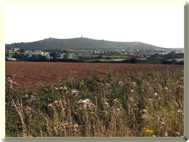
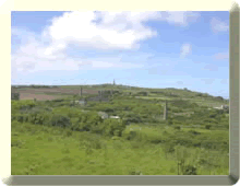
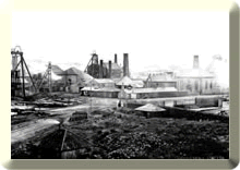
This mining district is dominated on the skyline by the granite outcrop of Carn Brea. The district has been a large producer of copper and tin in the Cornubian Orefield. Mining had been continuous from pre-history up to the end of the 20th century and as a consequence has excellent mining landscapes. At one time it had the world's deepest mine at 1000 m deep at Dolcoath in the late 1800s. As a result of this past activity there is a very high density of mine workings in the district.
|
|||||||
|
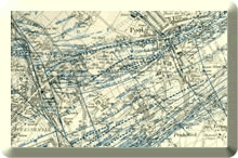
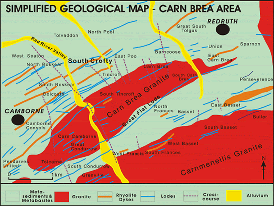
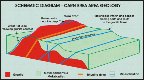
The geology is dominated by metamorphosed pelitic rocks with minor metabasites, which have been intruded by the Carnmenellis granite. Carn Brea is a small cupola, formed as a topographic high on the underlying granite. On the top of Carn Brea there is evidence of early magmatic mineralization in the form of greisen veins. Stresses related to the granite intrusion into the country rocks and subsequent cooling has resulted in fracture zones (normal and reverse faults), which are now occupied by fissure lodes. The lodes have formed on the flanks of the granite in metasediments and extend into the granite
|
|
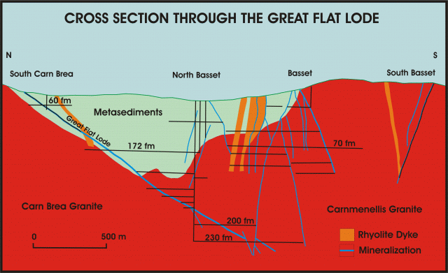 |
After Dines, 1956. |
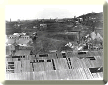
South Crofty Mine ceased working in 1998. Parts of the mine had been in operation as early as the 1700s as it had embraced many old workings during the lifetime of the mine. |
|
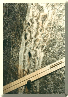
The mine geology is one of metasediments and metabasites in the upper part of the mine to granite in depth. In the mining sett (mining boundary) there are a multiplicity of fissure lodes. These lodes strike ENE-WSW and are up to 2 km long and have a dip length of 600m from surface. |
||
|
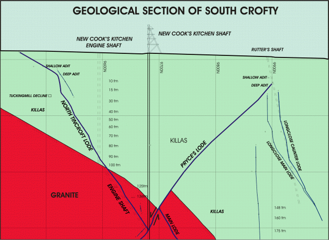
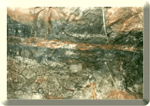
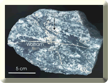
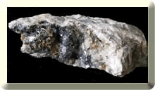
In the upper part of the mine the lodes were sulphidic (sulphur rich) and worked for copper, zinc and minor lead; in depth this changes to cassiterite and wolfram. However tin is present in the upper part of the sulphide rich lode systems as the sulphide mineralization post-dates that of the tin due to a collapsing hydrothermal convection cell. Tin grades in recent years ranged from 1 to 1.5% Sn, but locally could occur up to several tens of percent. |
|
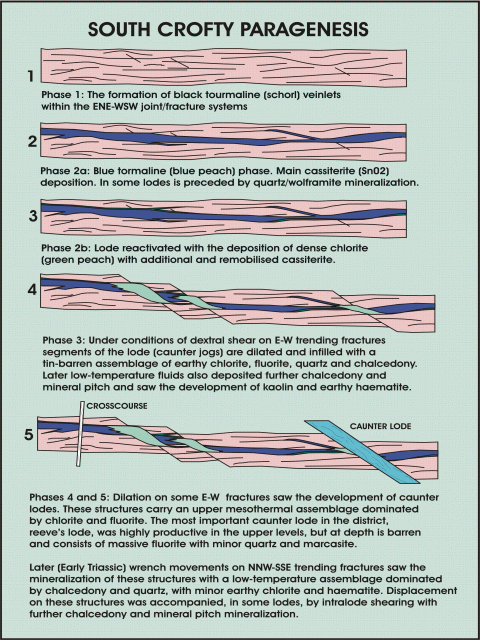
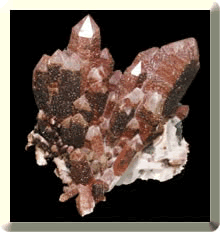
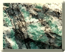
Six main phases of mineralization can be recognised in the mine. 1) Early sub-horizontal greisen mineralization in the form of quartz veins with wolframite, arsenopyrite minor sulphides and feldspar representing the change from magmatic to hydrothermal mineralization. 2) An early black tourmaline with cassiterite phase. 3a) A blue tourmaline phase with cassiterite. Often these are brecciated as a result of explosive decompression. 3b) A chlorite cassiterite phase with fluorite and quartz. 4) A tin-barren fluorite phase. 5) A caunter lode phase with fluorite and subordinate quartz/hematite/chlorite and marcasite. 6) The crosscourse phase of infilled wrench faults filled with clay and/or chacedonic quartz, hematite, and occasional copper and bismuth sulphides.
|
|
Other virtual geological field excursions in PDF files are for:
West Penwith, (2.83MB)
Marazion to Porthleven, (1.22MB)
Porthleven to Polurrian, (0.67MB)
The Lizard, (2.11MB)
St Austell Area, (1.40MB)
East Cornwall, South Devon and Dartmoor. (1.73MB)
Click on the one you wish to visit and download.
This site was last updated on
Friday, October 7, 2005 1:58 PM
.
Webmasters : Simon Camm & Paul
Hedley